Alteia R2023.07 release note
Your sites > All industries |
Measurements - SRTM database
|
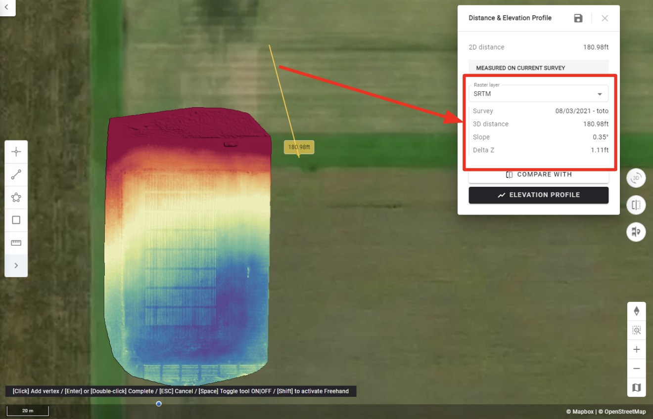
It is now possible to take measurements based on the Shuttle Radar Topography Mission database (SRTM) for:
Measurement Point: elevation
Measurement Line: 3D distance, Slope, Delta Z
The SRTM is automatically selected when no DSM or DTM is available in the area.
User benefit: elevation measurements are now possible even when the user has not supplied elevation data (DSM, DTM).
Ex: for users working with satellite images only.
Limitations: it is less precise than a DSM or DTM; the SRTM resolution will depend on the area of interest.
Currently not available: SRTM display on a map, Area, Volume, elevation profile.
|
|
Your sites > All industries |
Elevation Model to Point Vector analytics
|
The Elevation Model to Point Vector analytics is now available to all users.
This tool converts surface files, such as DSMs or DTMs, to point vector files in DXF format. The new DXF file is then available in the download section at the user specified resolution.
User benefit: users can convert their large surface files to a point file in a common DXF format that can be easily ingested into their CAD, Planning, GIS, other software.
For more information, please refer to the Knowledge base article
|
|
|
Convert to field boundaries
|
The “convert to field boundaries” task now works for annotations linked to the site.
|
|