|
Alteia Release R2024.17_Eng
Summary
- Data Studio - 3D view
- Data Studio - Annotation management tool
- Stockpile module
- Data acquisition module
- NEW - Data management module
- Photogrammetry - Pix4D V2 and Metashape upgrades
|
| |
|
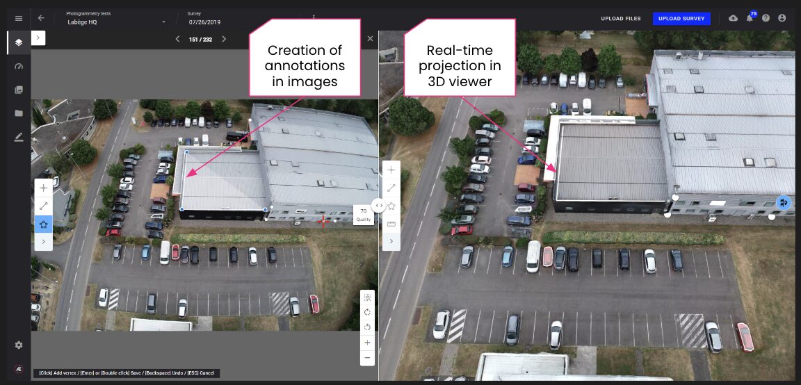
3D projected annotations and split view
|
|
Infrastructure inspection or engineering companies, often requires booth 3D and 2D analysis. Several enhancements have been made to improve the user experience when interacting with the images and the 3D model at the same time.
You can now project 3D annotations onto related 2D images and create ‘3D annotations’ directly from the 2D images. In both cases, the annotation remains a ‘3D annotation’. This means that a single annotation in 3D can be visible in one or several images without duplication.
This feature needs to be activated in Project settings.
3D inspection projected annotations
|
|
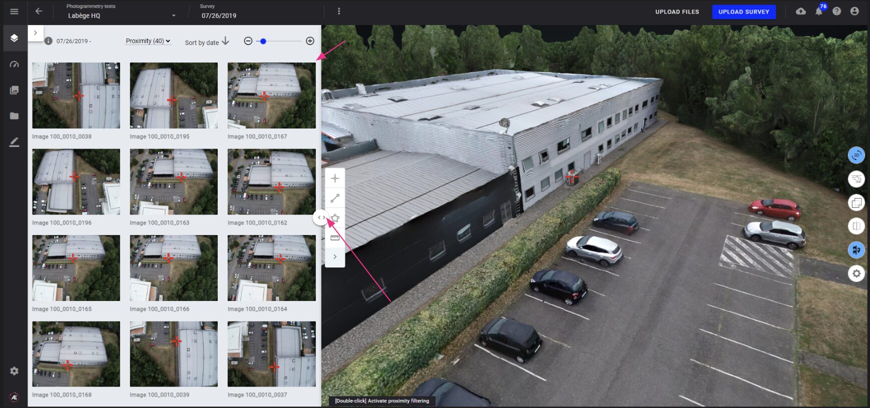
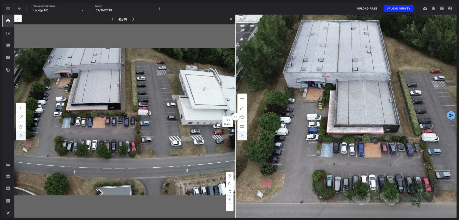
- Customization of the 3D model split view mode
Possibility to change the size of the gallery vs 3D and optimize the size of gallery margins.
|
|
|
Possibility to open an image in the split view, to visualize a single image and the 3D model at the same time.
|
|
|
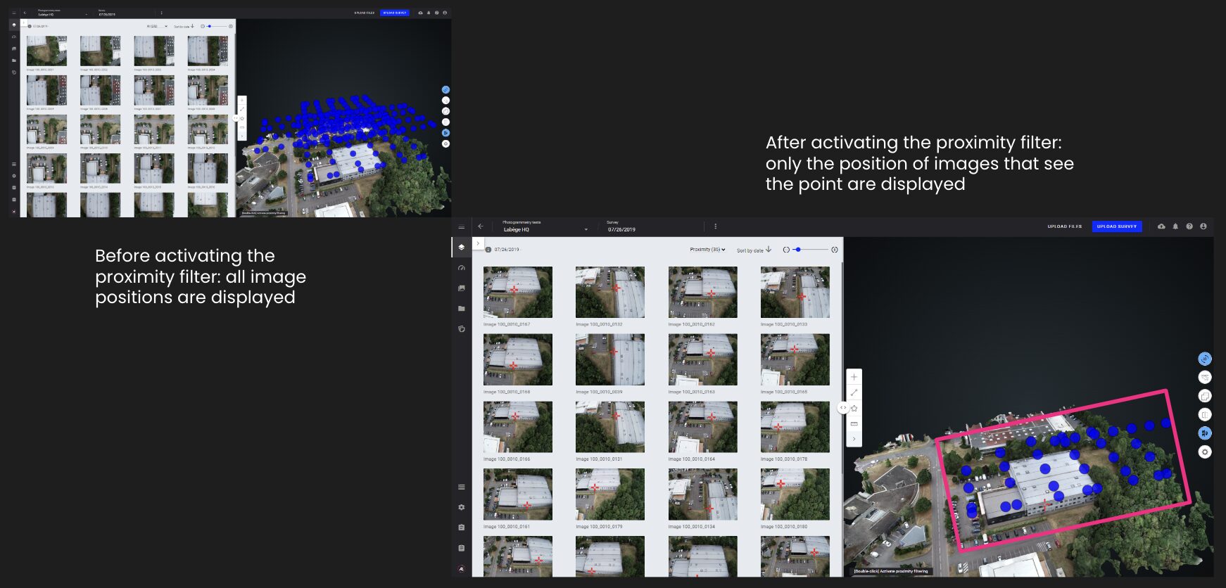
When activating the proximity filter, only the position of images that see the point are displayed.
Advanced 3D viewer
|
|
| |
|
3D local frame
|
|
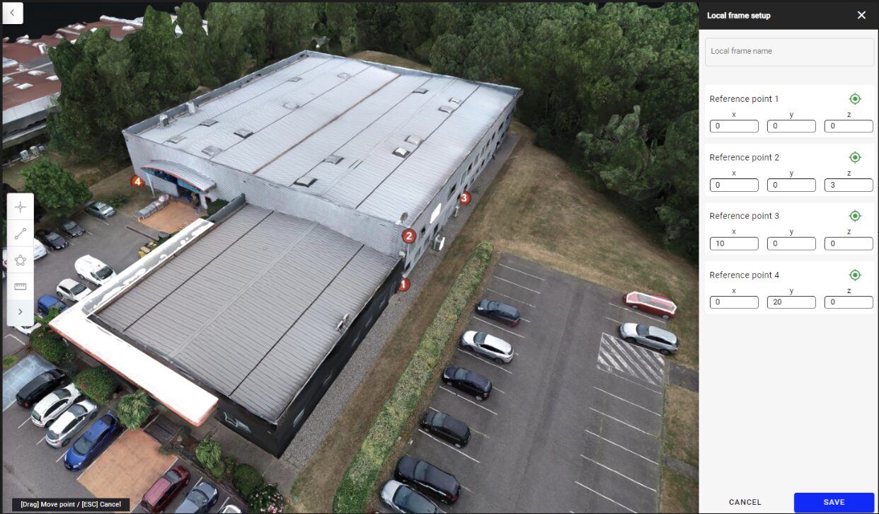
For 3D inspection, it may be required to use the asset local frame instead of geographic coordinates.
The platform enables to set asset local frame in 3D for:
- visualization of coordinates in local frame
- measures in local frame
- export of PCL in local frame
3D local frame
|
|
| |
|
Export cropped PCL from 3D viewer
|
|
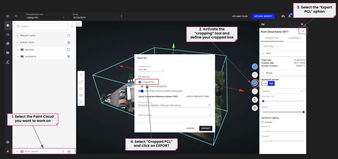
Large point clouds (PCL) are sometimes too voluminous to be ingested in third party tools.
To handle this issue, a capability to export a cropped PCL has been developed in the 3D viewer.
Export point cloud from 3D viewer
|
|
|
Data Studio - Annotation management tool
|
| |
|
New feature
|
|
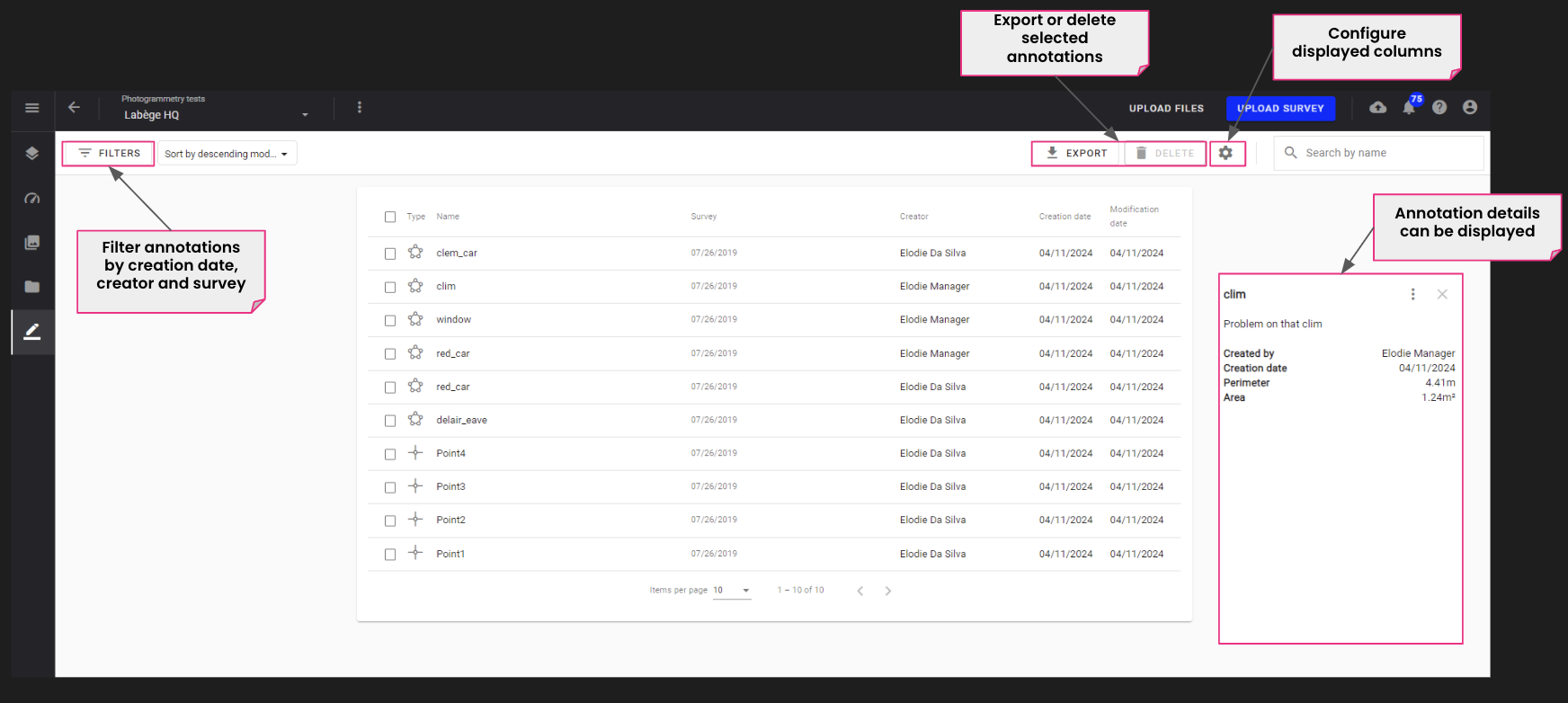
User can now list all annotations available on a specific project and display, filter, export or delete selected annotations.
Annotations explorer
|
|
| |
|
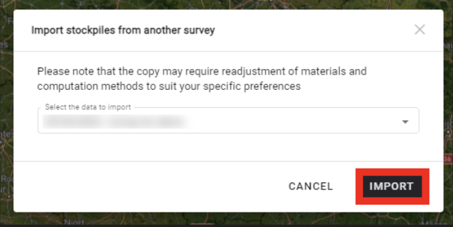
Self-service stockpile recycling
|
|
The “import stockpiles” option enables the replication of stocks drawings, material types allocation and monetary value calculation from one survey to another. It can be re-synchronized at any time.
This option is available if another survey contains some self-service stockpiles and if there is a DSM on the current survey.
|
|
| |
|
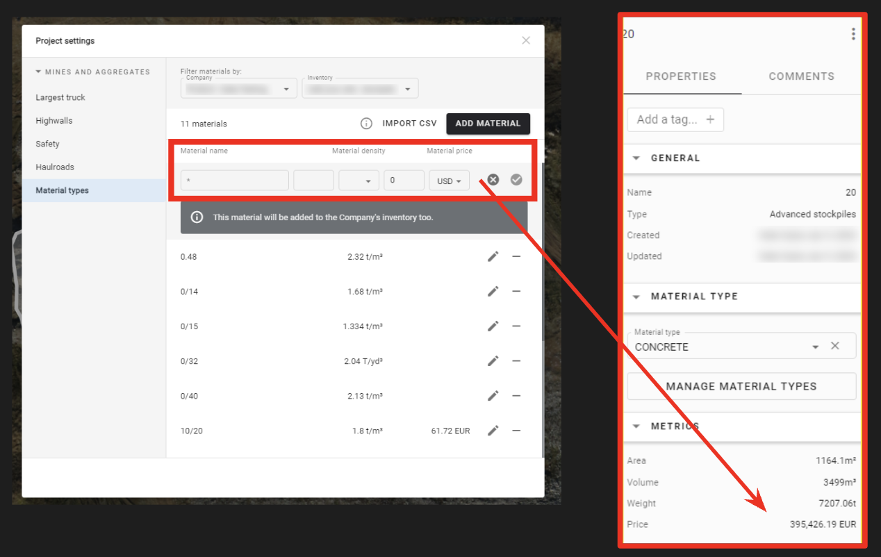
Stockpile monetary value
|
|
Stockpile prices are automatically computed according to material settings. Most existing currencies are available.
|
|
| |
|
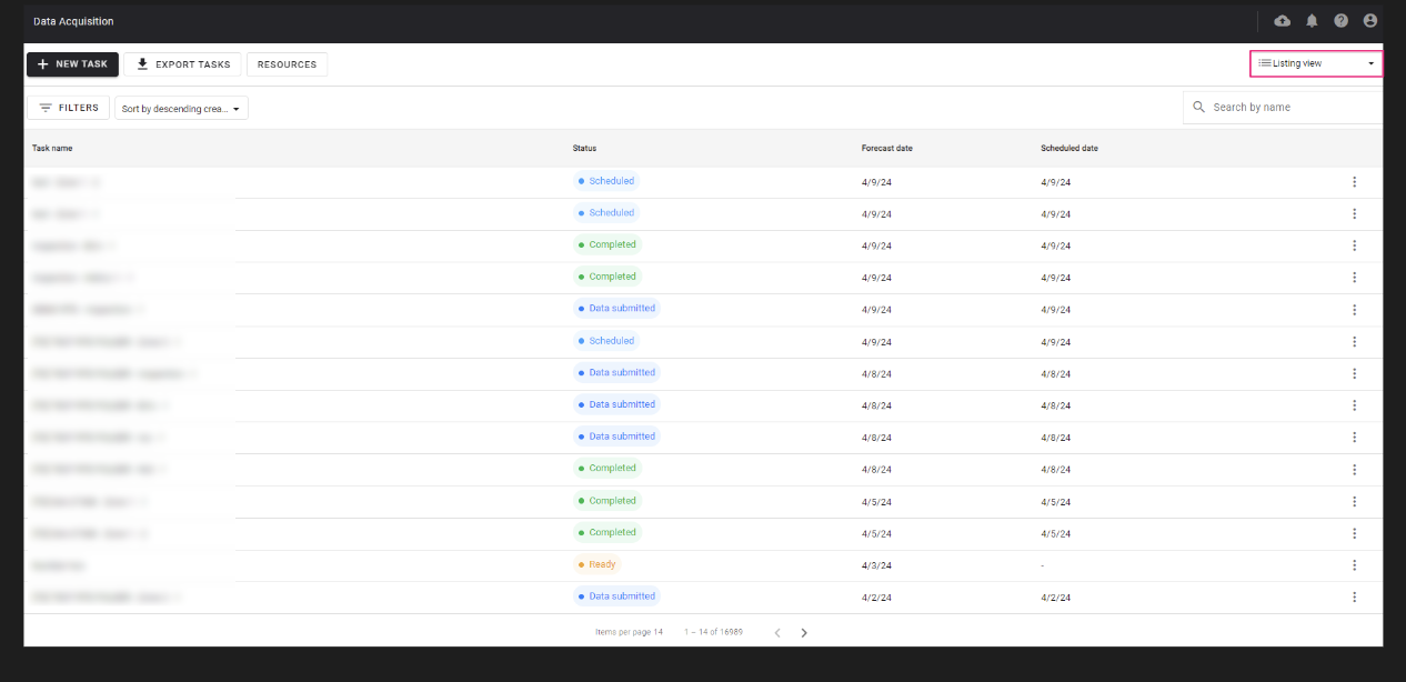
Capture tasks monitoring improvements
|
|
To help monitor capture task activity and verify capture task completion, users can now:
- access the list of capture tasks through a new “listing” view
- export tasks in a CSV file
Data acquisition module
|
|
|
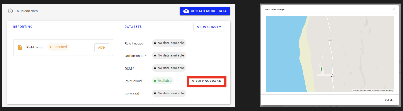
Users can also control and validate the flight capture coverage thanks to a viewer that overlaps the point cloud footprint vs mission area (for lidar capture only).
Data acquisition tasks management
|
|
|
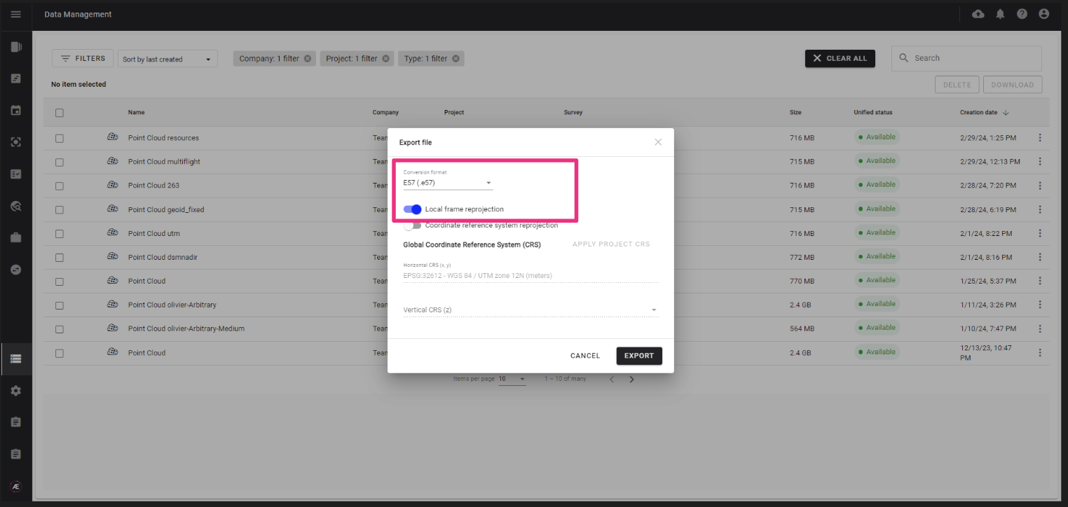
NEW - Data management module
|
| |
|
Improved data accessibility, data management and data interoperability
|
|
The Data management module enables:
- centralized access to any data for consultation
- bulk download and deletion from multiple projects, surveys and companies
- export point cloud file in local frame and e57 format
This feature is for Enterprise customers only:
- available by default for Domain manager
- for other users, 2 options :
- upgrade of existing roles or
- creation of new custom roles
Data management – dataset deletion
Data management – dataset export and download
|
|
|
Photogrammetry - Pix4D V2 and Metashape upgrades
|
| |
|
Pix4D V2 deployment by default
|
|
Pix4D engine V2 is selected by default when launching a RGB photogrammetry on all domains where it is activated.
In addition, the default settings have been adjusted to guarantee the best performance :
- “Deghost” is activated by default for 3D model generation
- DSM parameters have been integrated, to enable users to choose between rural or urban environment to get the best results according to their needs.
If presets were defined at company or project level, the original custom presets remain applied by default.
Guidance on how to re-define presets in accordance with Pix4D V2 is available in the knowledge base.
Photogrammetry engines and options
|

|
| |
|
Metashape upgraded version deployment
|
|
Metashape V2 has been integrated into the platform with improvements on the photogrammetry results.
All users having access to Metashape photogrammetry engine will now use Metashape V2 without any change to be done on their side.
Photogrammetry engines and options
|
|