Mine optimization
Leverage Alteia’s AI techniques to deploy more thoughtful road maintenance strategies that allow you to improve machine efficiency, productivity, and safety.
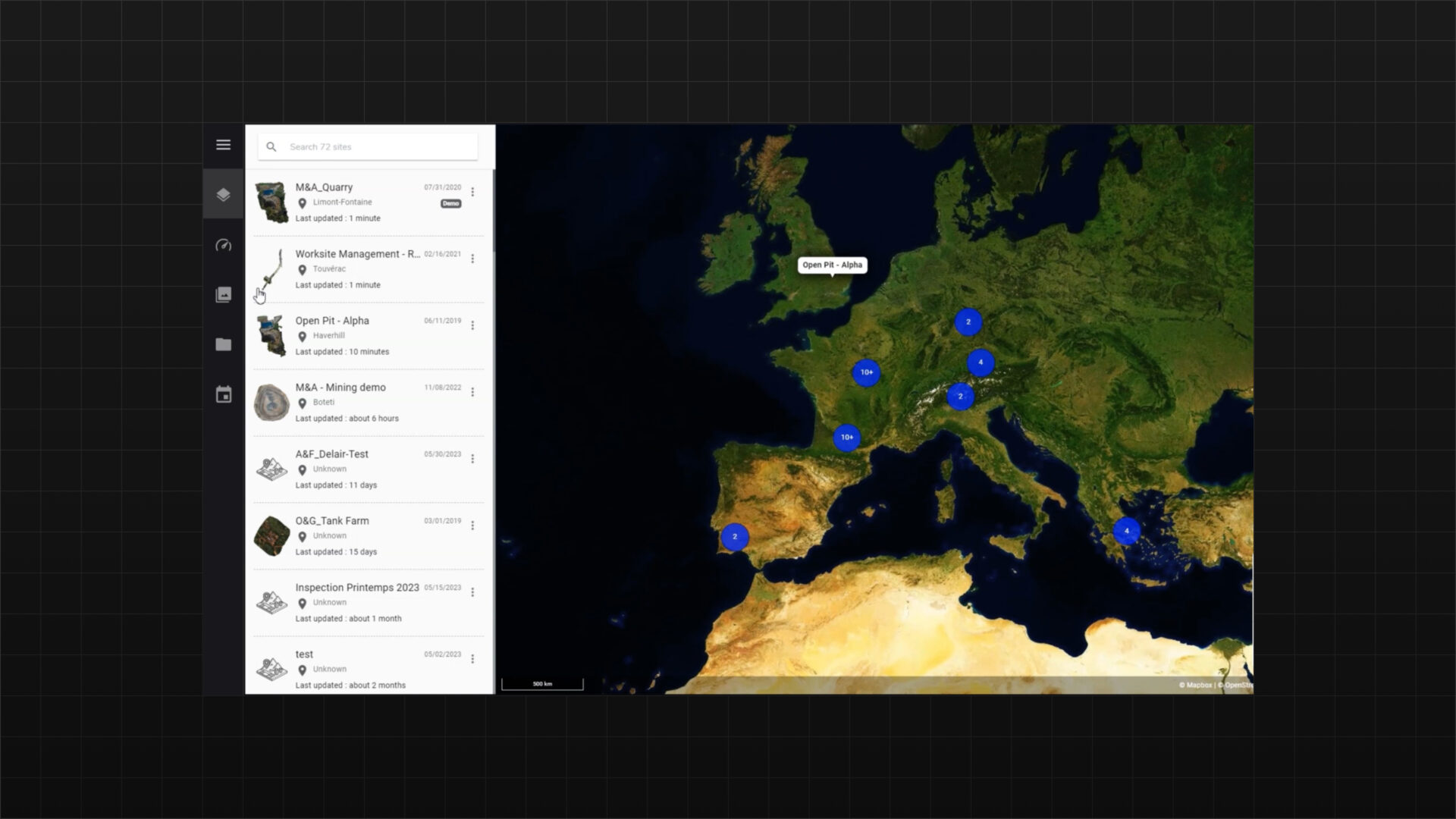
Contact usStore and analyze mine data
Alteia’s Mine Optimization uses AI to analyze images, orthophotos, and 3D data, enhancing haul road safety and efficiency in mines. By extracting road geometry and key features from geospatial data, it helps improve safety and meet environmental goals.
Facilitate your data capture tasks from multiple sources and providers
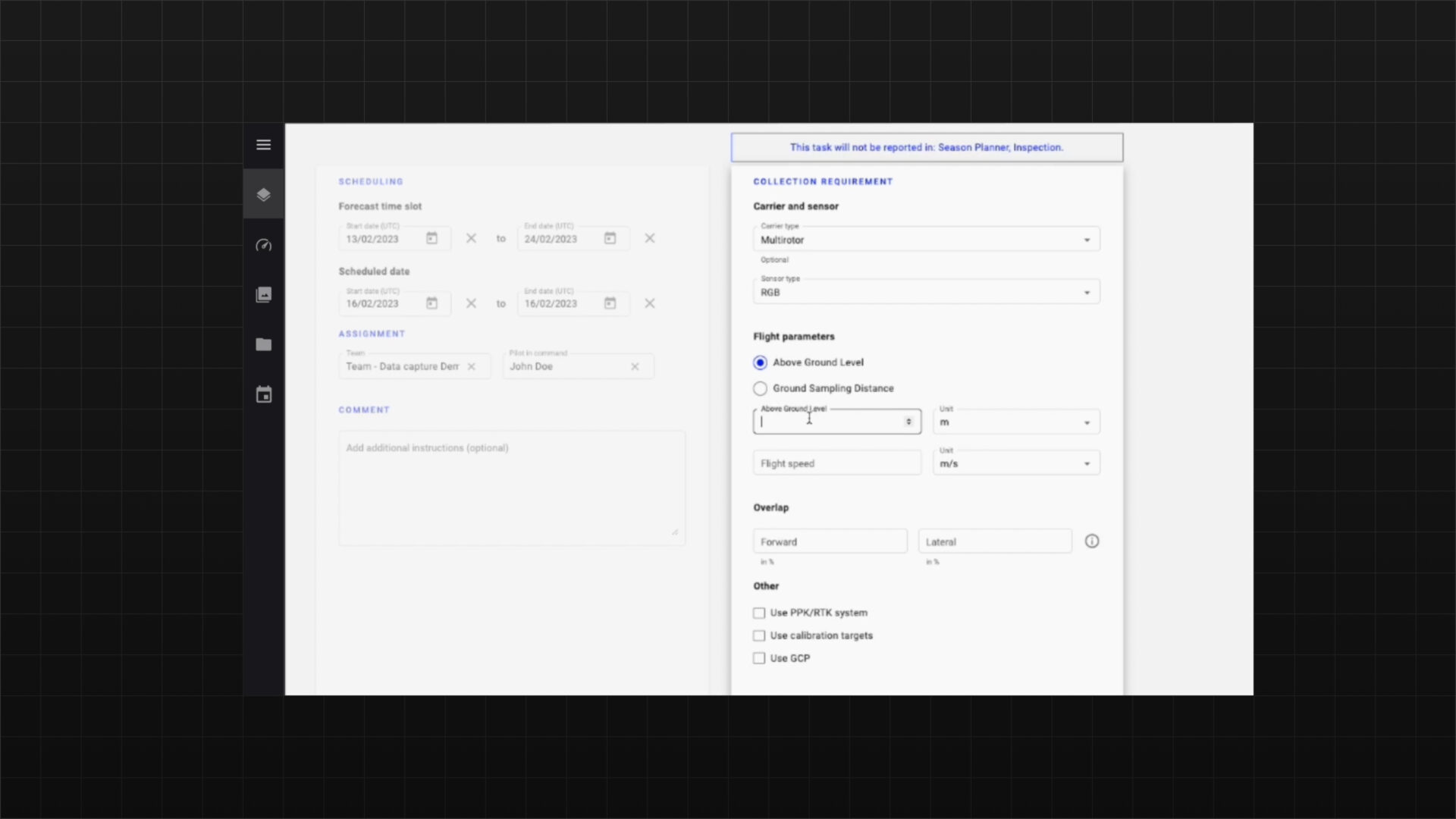
Part of the application, the data capture module efficiently manages data collection operations. It ensures timely data acquisition, automates quality checks, and creates reports to track performance.
Automated haul road analysis including slop grades for fuel and emissions optimization
Automate the analysis of haul road conditions to guide maintenance and enhance machine efficiency, productivity, and safety. The tool uses geospatial data from surveys to extract road geometry and displays details like boundaries, slopes, and breakpoints on an intuitive interface, allowing users to measure changes in length, slope, elevation, and more.
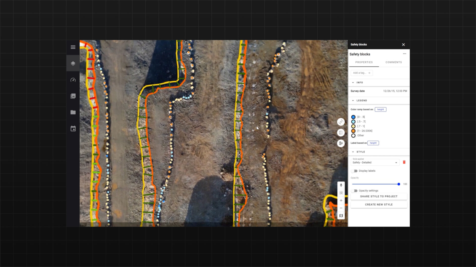
Extract automatically specific features impacting the safety of your operations
Automatically calculate and visualize key quarry or mine site features affecting operational safety, such as highwalls, safety blocks, and berm conditions.
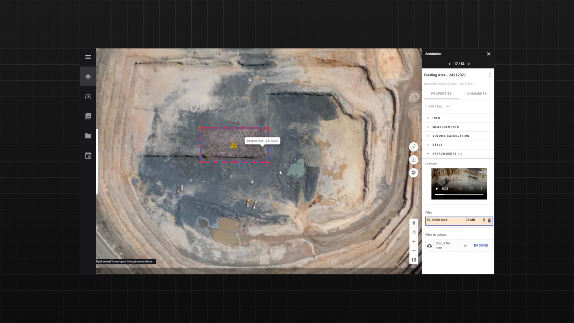
Analyze efficiency of drilling and blasting operations
Integrate drilled data into your bench model and compare it with the drill design to enhance drilling performance. With AI-driven analytics, visualize your muckpile shape after blasting, measure its efficiency, and adjust your workflow accordingly.
Assign specific resolution plans to teams and perform inter-site comparisons
Leverage the integrated collaboration tools to assign specific tasks to operators and track the completion of these tasks.
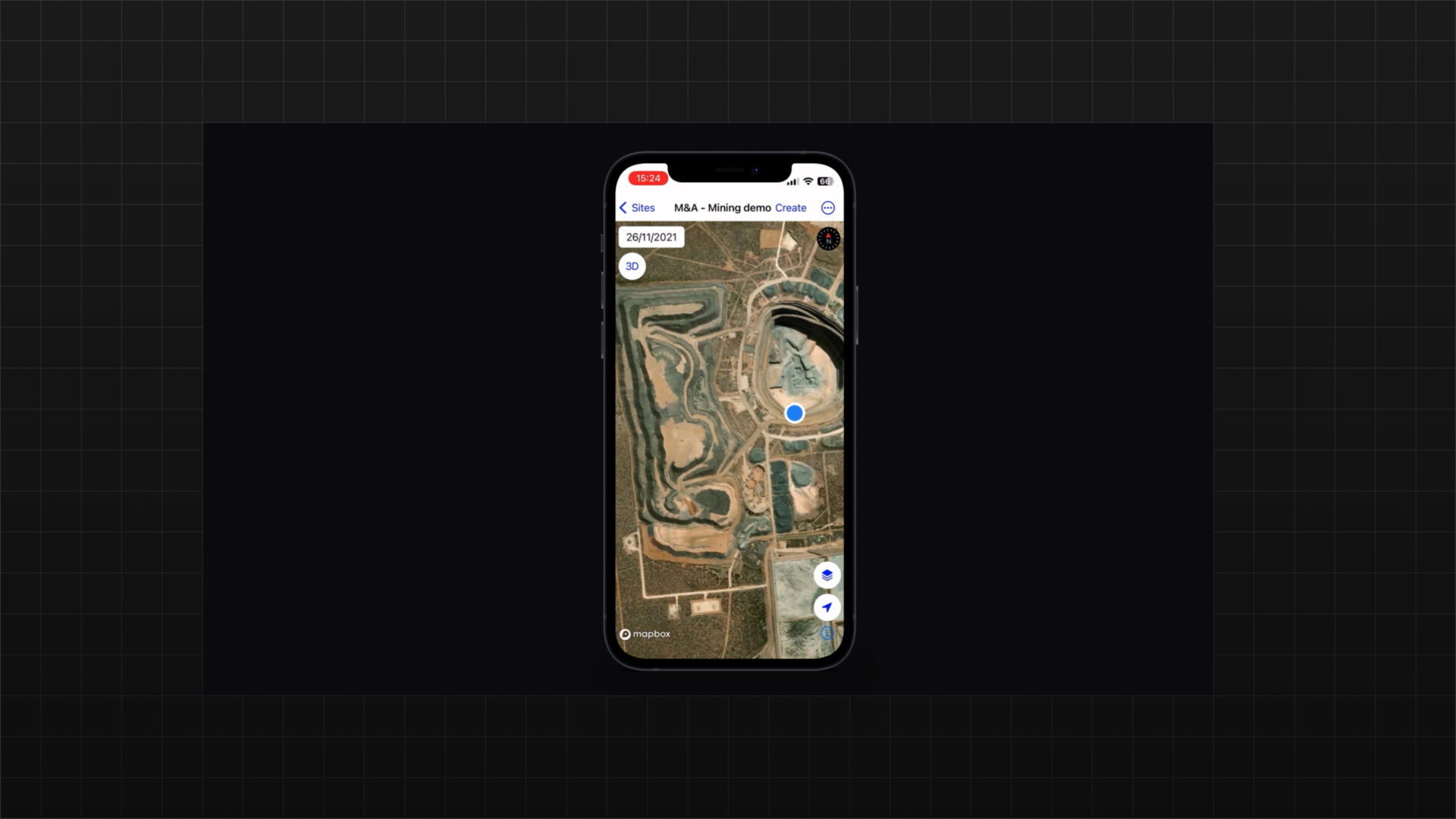
Leverage the mobile application to report safety issues, or check safety analytic results
Access data anytime, anywhere with the mobile app.
Enable your team to collaborate from a single source with annotation tools, task creation, and assignment features.
Use the app to simplify communication with mobile 2D/3D maps and for adding new data or validating field work
Benefits
Optimize operations, enhance decision-making, and automate data processing and monitoring for improved efficiency and risk management. With flexible architecture and real-time insights, we enable businesses to integrate AI seamlessly, driving productivity and cost savings.

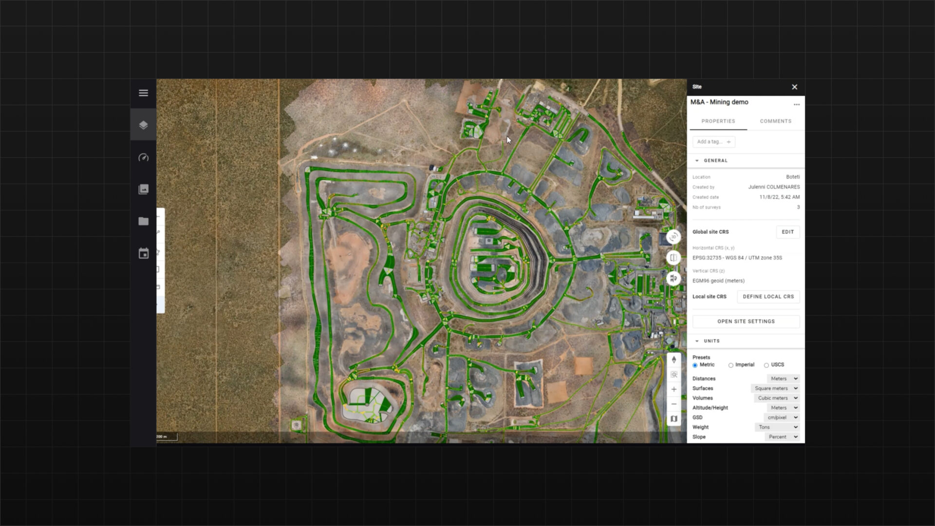
Share data across your organization
Provide your team with immediate access to the status of a mine site or quarry. The application centralizes site documentation, enhancing collaboration and enabling surveyors, engineers, and site managers to work more safely and efficiently.

Meet your sustainability goals
Lower the fuel consumption of your haul trucks, resulting in a significant 15 to 20% reduction in your carbon footprint. By optimizing routes, improving driving efficiency, and maintaining equipment, you not only cut fuel costs but also contribute to sustainable mining practices.

Decrease operating costs
Gain access to tools that help boost mine productivity, optimize truck fleet management, reduce fuel consumption, and lower tire maintenance costs.

Maintain the highest safety standards
Effectively manage safety and maintenance while ensuring compliance with regulations through proactive strategies and regular inspections, minimizing risks and enhancing operational efficiency.
Technical features
Our application features advanced visual data analytics, real-time data processing, seamless integration with existing workflows, and scalable architecture.
Cloud-based
No need to install any software. Just log to your Alteia account and manage all your data from there, benefiting from elastic storage capabilities and high performance computing.
Annotation tools
Annotate your data and share with your team, and keep track of everything thanks to the data archiving capability of the platform. Enhance your communication and knowledge of the site inside and outside of your organization.
Photogrammetry engines
Easy-to-use measurement tools
Measuring your haul roads features takes just a few clicks, and on-screen calculators and analysis tools make measuring volumes, surface areas, road grades, elevation, cross-sections, and cut/fill very easy.
Change maps

Design files import
Quickly identify differences between your site design and the current conditions.
Powerful analytics
Use our AI-powered analytics for haul road performance management and simulating fuel and carbon emissions reduction.

No programming required
No need for a data scientist or expensive custom programming.
High level of customization
The application can be configured to your specific needs.

Quick data turnaround
Your surveys and analytics are processed, QA’d, and ready to view within hours.
Vision data inputs
Pricing
- Up to 10 seats
- APIs for output integration only
- Pay per use for photogrammetry
- Pay per use for analytics run
- Online community and training
- Level 1 analytics integration
- Custom application development
- Access to SDK and APIs
- Dedicated account management
- Premium support
Industries
This Alteia application already helps the Mining & Aggregates industry and the following clients.