Enedis chooses Alteia for its smart vegetation management program
As a result of climate change, utilities have to cope with high-intensity weather phenomena (violent winds, drought, storms, etc.), leading to large-scale power failures or deadly events such as the Campfire fire in California in 2018, which was triggered by a faulty component on the network and amplified by a severe drought and very violent winds.
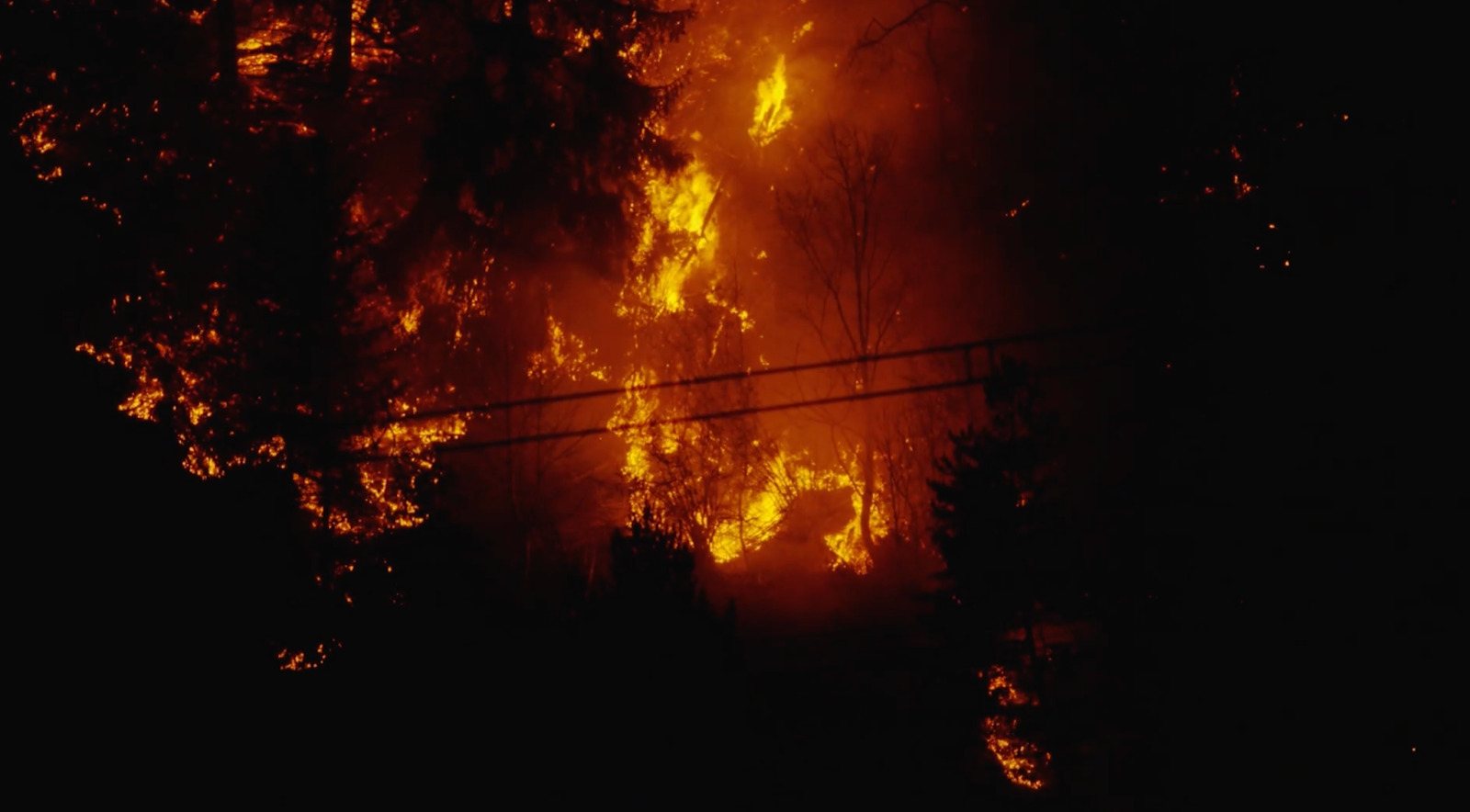
All these incidents have one common denominator: vegetation near power lines. Managing vegetation is therefore proving to be one of the most critical tasks for utilities, at a time when electricity production is becoming increasingly decentralized, creating additional pressure on the network. Given the scale of the task, it represents staggering operating costs.
According to Accenture, network operators spend between 6 and 8 billion dollars each year on the maintenance and control of vegetation on overhead lines. Operators therefore face a major challenge: finding the right balance between controlling costs for taxpayers and minimizing the risk of incidents.
Faced with this challenge, the use of an intelligent and efficient vegetation management system is essential. By digitizing processes using artificial intelligence and visual data, vegetation management around power lines can be drastically accelerated and optimized, reducing costs and minimizing the risk of fires and outages.
The challenges faced by ENEDIS Aquitaine Nord
ENEDIS, manager of the public electricity distribution network covering 95% of France, has been working with Alteia since 2018 to modernize its approach to managing vegetation issues.
As part of ENEDIS new 2020-2025 industrial plan, the company’s investments in predictive maintenance programs contribute to the ecological transition for an increasingly resilient and innovative public electricity distribution network.
Every day, with the coordination and involvement of hundreds of people, ENEDIS collects images of its network using helicopters, drones and its field agents. These images are then uploaded to the Aether platform developed by Alteia, where the data is processed and analyzed.
Alteia has set up two workflows for managing ENEDIS vegetation on the Aether platform:
- Vegetation inventory: this involves collecting and analyzing data in order to make an assessment about the state of the vegetation around the lines, and to determine whether or not these areas need pruning. Depending on the position and distance of the vegetation from the line, a risk is calculated. This risk varies from low to extreme and is used to prioritize pruning operations and generate a list of work orders with different urgency levels.
- Pruning control: work orders are then sent to pruning companies who carry out the pruning work. The purpose of this service is to ensure that the pruning is completed as planned. It is used to make sure that what the contractor (pruning company) is billing is correct and that there is no “highly critical” vegetation left around the network.
Data collection using different acquisition methods
AI-based vegetation management has two components: data collection and data analysis. First, let’s focus on data collection.
Traditional vegetation management systems rely on manual inspection of the lines to determine which trees need special attention. Once a year ENEDIS inspected 1/4 of the total network. After 4 years, the entire network was analyzed.
It is virtually impossible to get a precise overview of all the areas that need to be trimmed at all times using this approach.
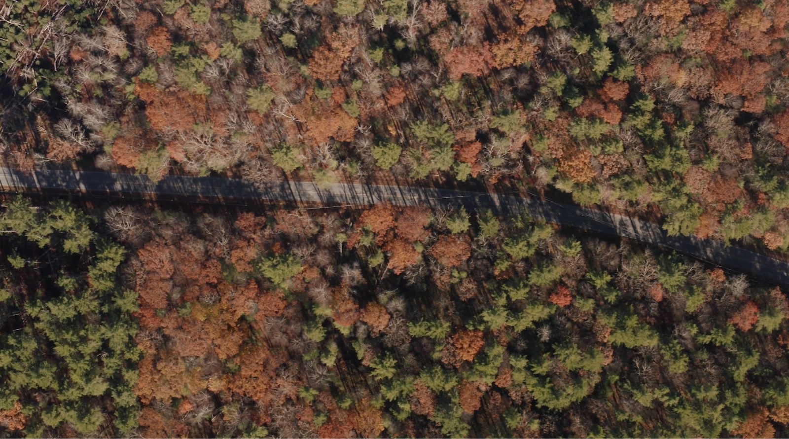
To cover more ground and make more effective decisions, data can be collected over the network using new technologies: drones, planes, helicopters, satellites, vehicles or smartphones.
Satellite imagery plays a crucial role in vegetation management for operators, changing the way they monitor and maintain their infrastructure. Satellite imagery provides a comprehensive, high-resolution view of large areas, enabling potential risks to be identified and vegetation management efforts to be prioritized. These images provide valuable information about vegetation growth patterns, density and proximity to equipment, helping to detect potential hazards such as overhanging branches or invasive species. By integrating satellite data with Geographic Information Systems (GIS), network operators can accurately map and monitor vegetation changes over time, track the progress of brush clearance and plan targeted maintenance operations. This proactive approach reduces the risk of vegetation-related faults, improves system reliability and ensures the safety and resilience of their infrastructure.
However, satellites do not provide a very precise view of what is happening in 3 dimensions around the lines. To do this, ENEDIS uses a mix of helicopters and drones, which are an efficient and more environmentally-friendly alternative. By processing LIDAR data or using a photogrammetry process on drone imagery, network operators are able to model the environment close to power lines very accurately.
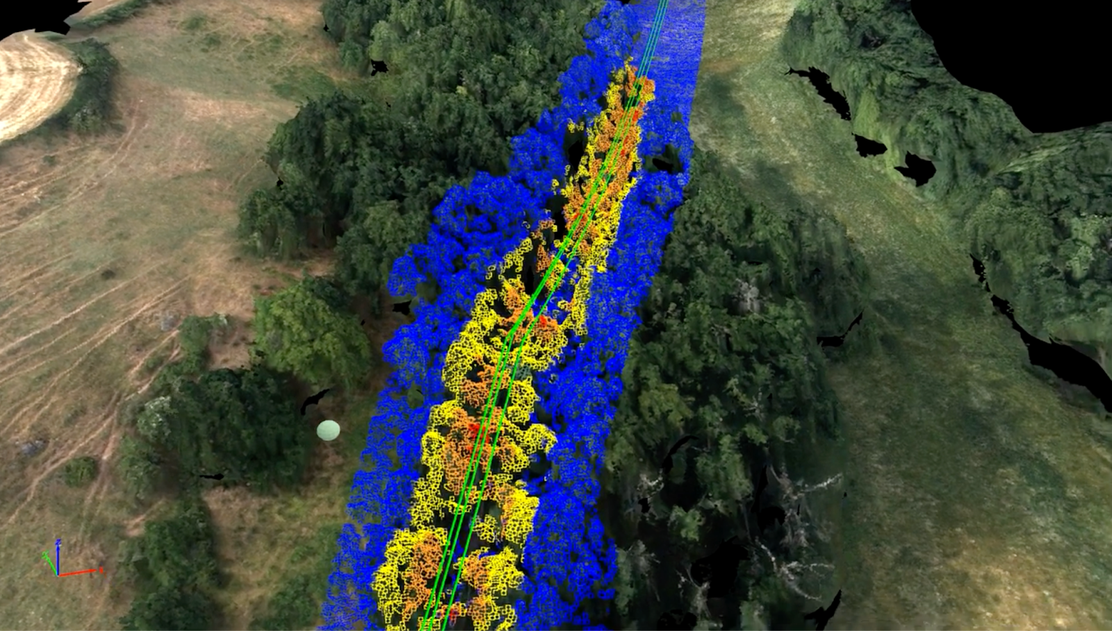
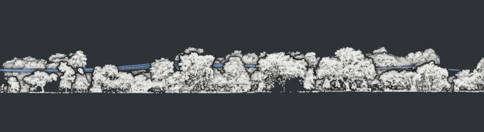
Lidar (Light Detection and Ranging) data, or photogrammetry data generated from a batch of drone images, are increasingly being used for vegetation management, to complement the information provided by satellite imagery. Lidar technology uses laser pulses to measure the distance between objects, generating highly detailed 3D maps of the earth’s surface. On the other hand, photogrammetry is the art and science of extracting 3D information from images. The process involves taking overlapping images of an object, structure, or space, and converting them into 2D or 3D digital models. Both technologies allow the generation of point clouds.
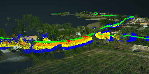
Applied to vegetation management, point clouds provide a more precise and accurate assessment of the height and structure of vegetation, as well as its proximity to lines. This level of detail means that potential clearance problems, such as branches close to power lines or trees growing too close to poles, can be identified more accurately.
Unlike satellite imagery, Lidar data offers a more focused and localized perspective, enabling targeted assessments and interventions and moving from a cycle-based to a risk-based approach.
Vegetation inventory
Once the vegetation data has been collected by the different means of acquisition, ENEDIS can then analyze it on the Aether platform using our “vegetation assessment” tools.
AI makes it possible to automate large parts of vegetation management processes. The primary objective of the vegetation management workflow is to determine the encroachment of trees on power lines. The aim is to schedule and prioritize maintenance operations and pruning work.
Previously, this work was carried out periodically according to a fixed schedule. Pruning companies could use data from the previous year to predict the results for the coming season. Such a process has proved to be less than optimal and less than accurate. In fact, pruning is not carried out as closely as possible in order to reduce risk, but according to a conservative plan that resulted in clear-cutting along the entire network in order to last at least one calendar year. This was also less environmentally friendly and much more costly.
The use of AI-based technologies and visual data collection is moving away from a pruning approach based on this cyclical approach to one based on risk predictions, allowing operators to focus more effectively on problem areas.
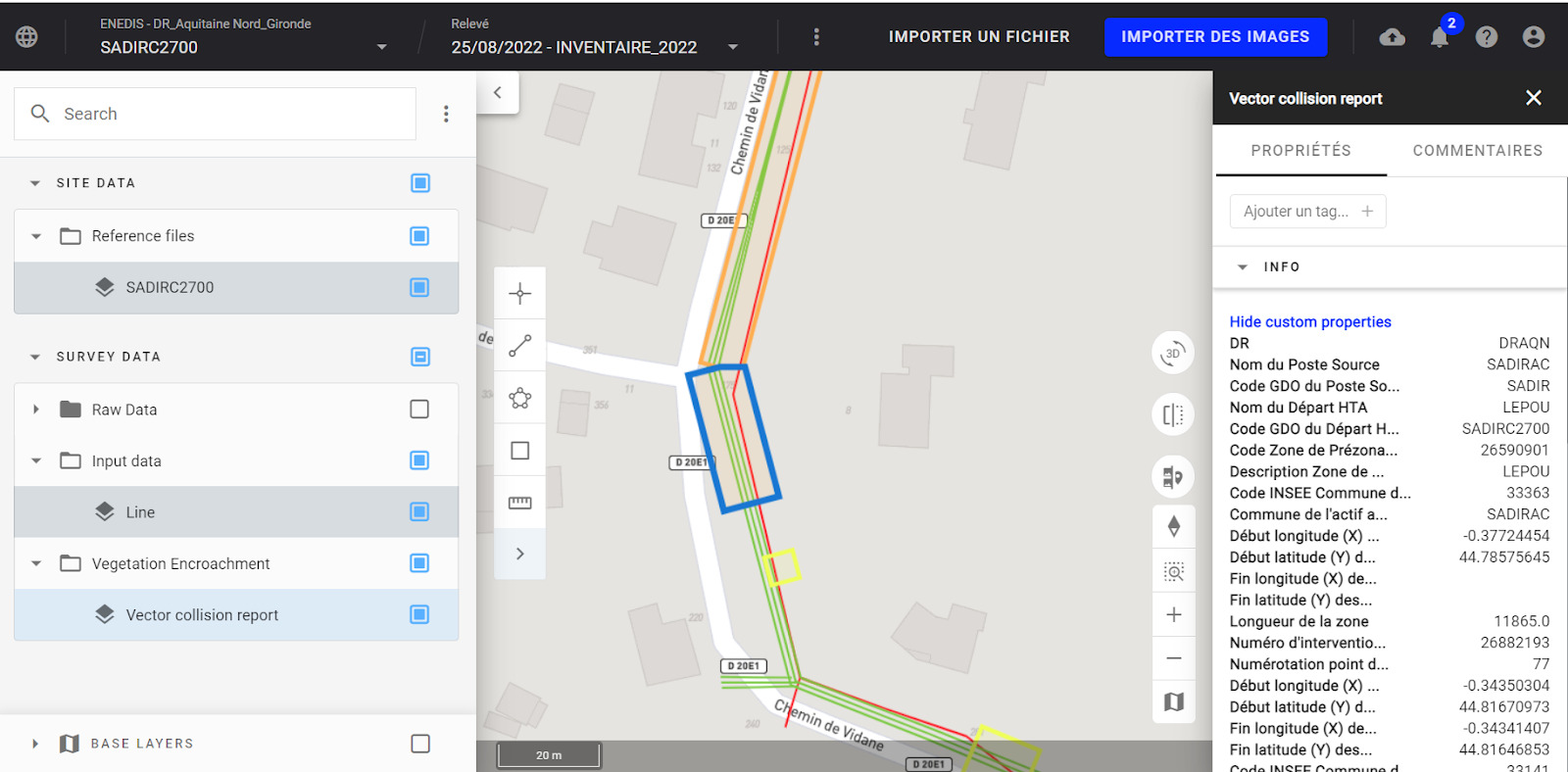
In particular, our platform enables to:
- Classify vegetation in the point clouds and vectorize automatically power lines (and poles as needed)
- Identify areas of vegetation close to power lines, and measure and quantify the distance and volume of non-compliance and levels of urgency
- Generate work orders based on their location and urgency. This AI-based workflow defines priorities, validates pruning contracts and carries out invoicing processes
- Record the history of inventories in order to compare the state of vegetation over several years and create vegetation growth models.
Note that some of the above features are not yet used by ENEDIS.
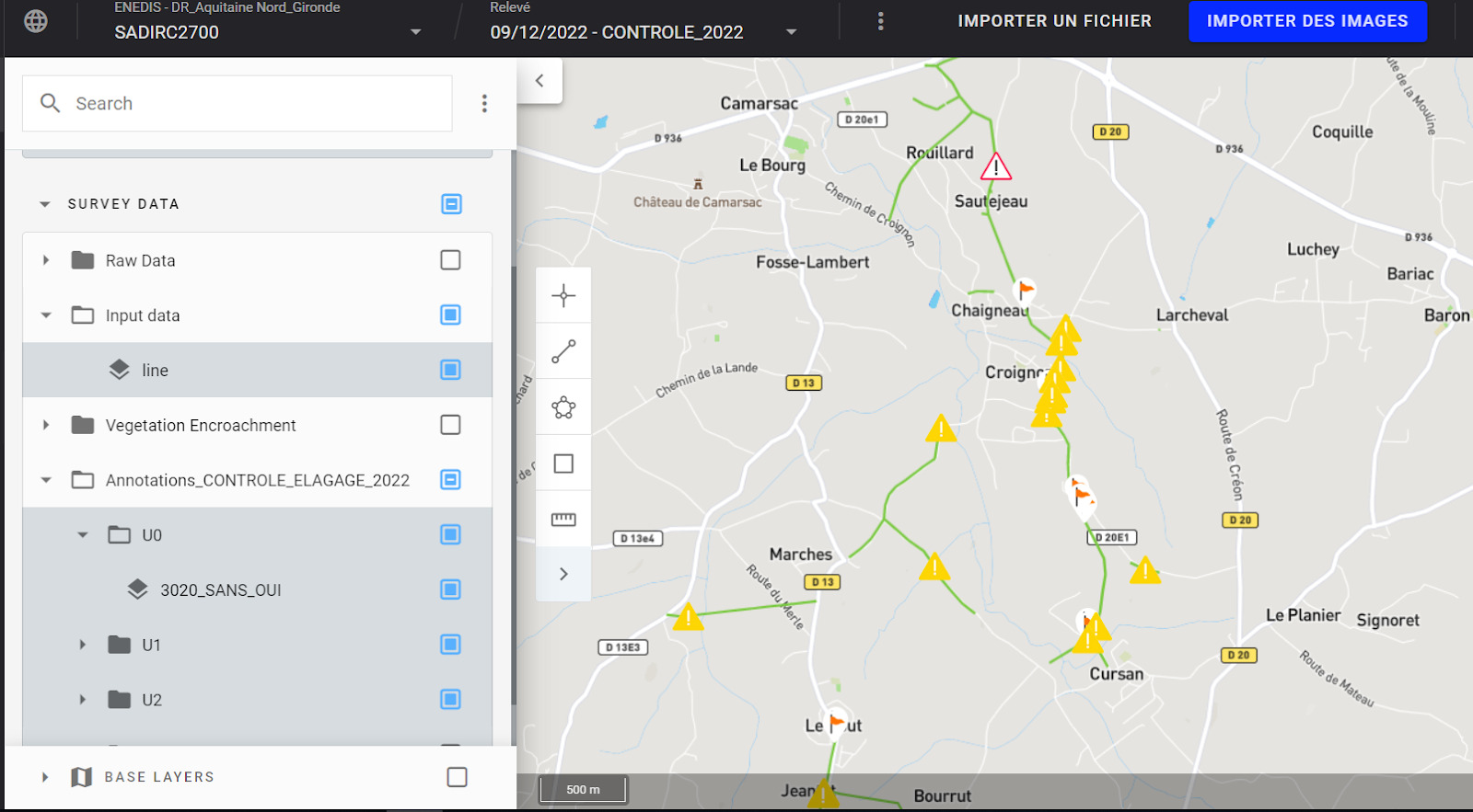
Checking pruning operations
Following the pruning operations, image collection and analysis is repeated on the Aether platform in order to control the pruning operations and their compliance with work orders specifications.
In practical terms, ENEDIS can visualize the results of pruning operations on the Aether platform thanks to our 2D/3D visualization tools, 3D comparisons between two given states, and easy reading of “pruning non-compliance” points.
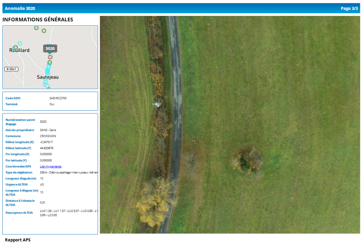
The results, which can be exported in .xls and .pdf format, are also made available to Enedis via its in-house e-elagage tool. Pruning service checks are well received by the pruning companies, as it gives more traceability to the process. For ENEDIS, it is highly valuable as it makes it possible to send the pruning companies back to “forgotten” areas, thereby improving the quality of service, minimizing downtime risks and optimizing operating costs.
The results
The Alteia solution has proved its value at ENEDIS, where it is used almost daily by the Aquitaine-Nord regional office.
Since 2021, more than 3,000 km of power lines have been analyzed every year on the Aether platform.
Thanks to the implementation of the vegetation inventory and pruning control service, ENEDIS has noted numerous optimizations on its network:
- Increased accuracy of vegetation inventories
- The possibility of carrying out small inventories of less than 5 kilometers by drone, where a helicopter would have to cover hundreds of kilometers at least to be cost-effective
- Faster generation of inventories : results are provided within 3 weeks
- Precise, systematic control of pruning operations, making it possible to carry out a control loop of felling operations
- Better pruning
- A shift from a “cycle” approach to a “risk” approach: better quantification of risks and a 2x improvement in the resilience of the infrastructure
- A drastic reduction in pruning costs, which can then be reinvested to better cover network risks
- Ultimately, a better quality of electricity supply.
Stéphane Delage, deputy head of operations at ENEDIS, explains:
“Today, the number of incidents is falling, which confirms that the technological choice and the solution we have identified are sustainable over time and will enable us to achieve our objectives”.
Conclusion
The implementation of Alteia’s AI platform, Aether, at ENEDIS enables the collection and analysis of vegetation data at scale around the network in order to minimize the risk of incidents and optimize the quality of power supply.
Drones are used to quickly and accurately collect the data, which is then seamlessly analyzed within the platform. Results are delivered within days.
Following this analysis, Alteia provides ENEDIS with vegetation inventories to assess the proximity of trees to power lines and to guide the work of the pruning companies. ENEDIS also works with Alteia to ensure that the pruning is carried out correctly and that the network is brought into compliance, with no high-risk areas remaining.
The goal is not to replace human labor with AI, but rather to provide operators with a tool that allows them to monitor the network more accurately, more frequently, and more efficiently, and to focus on high value-added tasks.
Frequent and intelligent vegetation management with AI increases service efficiency, reduces costs for users, and increases the safety of the power grid by minimizing future disruptions.
Watch a video of our case study here :