How vision AI is helping build a more sustainable future for agriculture
The agricultural sector faces a major challenge: feeding a world that demands more food at lower cost, using less land and fewer chemicals. According to Gjoko Muratovski, Forbes Councils Member and Director of the Ullman School of Design :
“AgTech development can benefit from agriculture to be aligned to at least nine out of the 17 SDGs (UN Sustainable Development Goals)”.
In order to grow better crops with less chemical inputs, water and land, farmers, agribusinesses and agronomists are working with new technologies. The use of visual data and artificial intelligence can help reduce waste and stress on the environment and thus have a better impact on climate change.
This article explores how vision AI helps farmers and agronomists make better decisions through easier access to data, and the development of predictive analytics to make effective business decisions.
Visual data access and availability
-
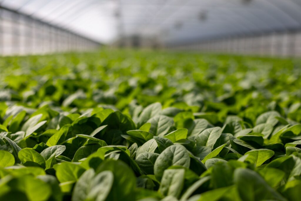
Data collection
Vision AI enables fast, consistent, and cost-effective visual data collection and contextualization. Rather than collecting plant-growth data manually, seed developers now use technology to capture and analyze high-resolution imagery coming from smartphones, drones, or satellites.
a. Drones and multispectral cameras
First of all, let’s see how agronomists use drones with traditional cameras or multispectral sensors. A multispectral camera uses as many single sensors as the number of wavelengths to monitor, ranging from visible range to near infrared. Combining the inputs of each sensor allows to compute vegetation indices that are key to evaluate plant and crop conditions. The data can be accurate within a centimeter or less, depending on the spatial resolution and the distance from the sensor to the ground, and is consistent across all research fields. The image processing also provides the plant density and plant height for each plot or microplot at different crop stages for a first yield estimation.
Using drones has become a commodity. In fact, it’s quite easy to create a pilot program and leverage drone service providers for data collection. With drones, the data acquisition process is fast, agile, and low cost. Drones like Delair UX11AG can cover 50ha per flight and a single drone covers min 300 ha per day. Associated with the Field Trial Analysis application from Alteia, it is the perfect option to start leveraging vision AI with zero risk, zero integration, and zero software development.
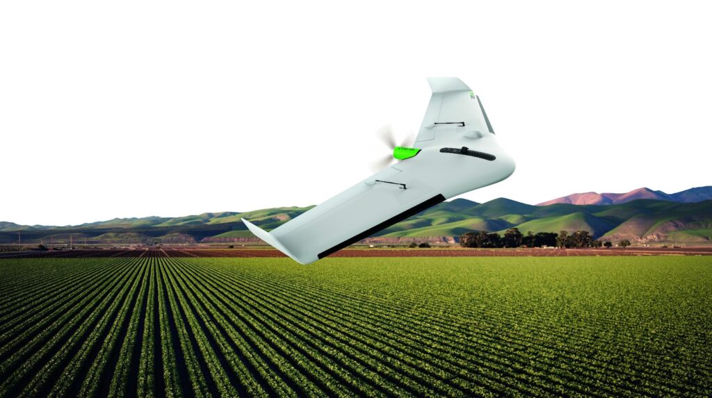
UX-11 fixed-wing drone equipped with a multispectral sensor by Delair
b. Satellites
With the improvement of image spatial resolution, satellites are beginning to play an important role as phenomics platforms. Satellite-based phenotyping technologies have the potential to evaluate plant traits at a large scale for seed production monitoring, leveraging the same techniques as drone-based image analysis for seed breeding.
Satellite imagery can be relatively cheap or even free when using low resolution data (Landsat, Sentinel). Such data – with some level of post-processing involved – can be leveraged to make macroscopic analysis for seed production monitoring.
For more precise analysis, companies like Planet or Satellogic provide 30 to 70 cm spatial resolution data, with very high frequency, up to 7 images a day over a specific point of interest.
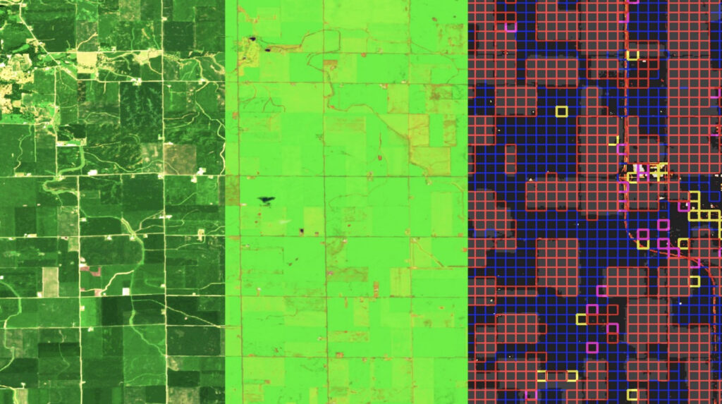
Example of satellite image processed to get a yield map
c. Other types of visual data collection systems
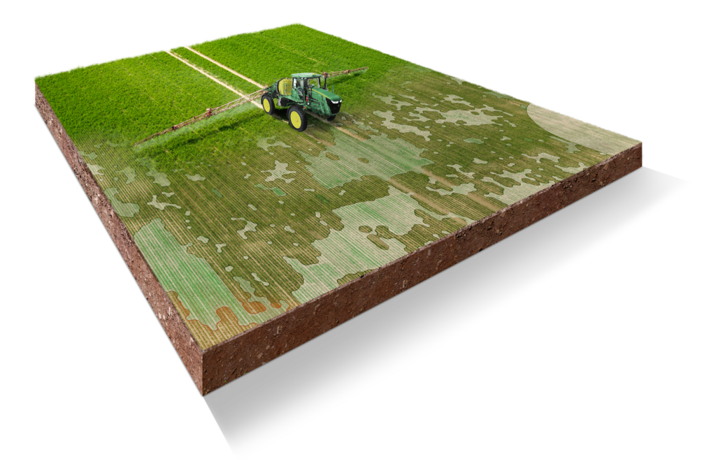
The See & Spray system, based on the See & Spray Select technology already marketed in the United States by John Deere, consists in detecting color differences in the field by means of cameras installed on the boom at more than 15 km/h, and so, with a real time analysis.
On the other side of the Atlantic ocean, Ecorobotix has developed in Switzerland the ARA solution. ARA is an ultra-high precision tractor-mounted crop treatment solution that uses high-resolution cameras and AI to instantly detect individual plants (crops and weeds) in real time. ARA then targets 6 x 6 cm areas to treat individual plants (without spraying the surrounding crops or soil), far surpassing conventional solutions that spray the entire field.
All of these technologies are helping access and capture new information about crops and fields. However it would not be possible to do it at scale without the emergence of cloud computing.
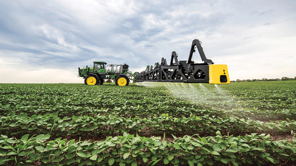
John Deere See & Spray system
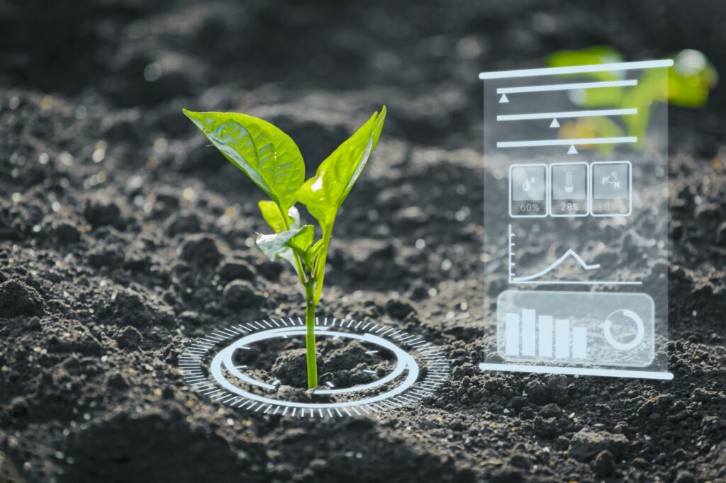
2. Data availability is a key enabler of vision AI
Cloud computing brings opportunities in terms of cloud storage and computing power. It’s not only becoming faster and cheaper to collect data, it is also easier to store and process it.
Cloud storage is a cloud computing model that enables storing data and files on the internet through a cloud computing provider that you access either through the public internet or a dedicated private network connection. The provider securely stores, manages, and maintains the storage servers, infrastructure, and network to ensure you have access to the data when you need it at virtually unlimited scale, and with elastic capacity. Cloud storage removes the need to buy and manage your own data storage infrastructure, giving you agility, scalability, and durability, with any time, anywhere data access, which is particularly relevant for visual data that is natively a very heavy data format.
Computing performance has drastically improved too. Ten years ago, processing data from a drone and creating vegetation indexes on a local desktop computer could take up to two days, now it’s done within minutes. Elastic cloud computing enables organizations to avoid the expense of building or adding capacity to their own data centers, and to rapidly access resources as needed. Storage, security, backup and retrieval, and disaster recovery services are also available through the cloud. As an example, Protealis, a seed breeder in Belgium using Alteia field trial analysis application, has noted that data availability has increased by 10 times since the implementation of our cloud-based solution.
Additionally, high-performance computing power coupled with a new generation of computer vision ML models allow to generate insights about crops in an automated way. Agronomists can visualize and analyze thousands of images within hours, with different objectives such as object detection and feature extraction, anomaly detection, measurement, tracking.
Vision AI is providing the tools to accelerate the digital transformation of the Ag tech sector
Vision AI companies like Alteia help agricultural companies integrate artificial intelligence into their daily operations, develop new seed breeding R & D practices, forecast seed production, and help generate more precise weed maps for weed management.
1. Seed breeding
Maps created from data collection can rapidly and efficiently reveal precisely the microplots attributes like plant count, vigor, height or health. For example, the Alteia Field Trial Analysis application is deploying digital phenotyping as a fast, efficient, accurate, and non-invasive way to evaluate the health of plants. By leveraging time series, AI algorithms can monitor changes over time. It helps speed up and scale field trial programs and easily compare one plot to another. As a result, R & D cycles are shortened by 30% and more varieties can be tested, which is a necessity in the context of climate change.
2. Weed management and precision agriculture
Certain algorithms can also be trained to detect specific weeds. With vision data coming from drones as an input, these algorithms can analyze where and how much weed is growing in a crop. It is generally associated with GPS-enabled sprayers with intelligent boom section shutoff and fertilizer nozzle control. That solution saves money on pesticides by allowing to apply them only where they are needed, not all over the field. The drone’s job is to scan the fields and map the weeds. Through a partnership with John Deere, Alteia has created a drone to tractor workflow. All information from drones with exact coordinates of weed plants is transmitted seamlessly to the John Deere Operations Center, where the company’s developments create an interactive map of weeds with their exact, up to 1 cm, location.
The tractor and sprayer are then synchronized with the Operations Center, so the sprayer applies weed control pesticide only in the right areas where it is necessary. If a farmer doubts or just doesn’t want to use drones, or the area where the field is located prohibits the use of drones, the farmer can make such a map based on satellite photos and his own knowledge.
3. Seed production monitoring and yield estimation
Crop growth monitoring and yield estimate information can be obtained via appropriate metrics such as the leaf area index (LAI) and biomass. Such information is crucial for guiding agricultural production, ensuring food security, and maintaining sustainable agricultural development. Traditional methods of field measurement and monitoring typically have low efficiency and can only give limited untimely information. Alternatively, methods based on vision AI technologies with satellites or drones are fast, objective, and nondestructive. Sometimes, the acquisition of satellite data is limited by the constant contamination of clouds in cloudy areas. In that case, using Synthetic Aperture Radar (SAR) satellite data and spatio-temporal data fusion approaches can be used as a workaround.
Vision AI contributes to make agriculture more efficient, precise and resilient to climate change. Thanks to easier and faster access to data, agronomists and farmers can make efficient business decisions based on visual data and artificial intelligence. At Alteia, we are committed to providing the best digital solutions for seed breeding, seed production monitoring and precision agriculture, in order to help build the next era of agriculture that is more data-driven and puts less pressure on the environment.
Want to know more about our platform and apps ?
Contact one of our experts
Summary:
Vision AI is not only about deploying solutions for an easier and faster access to data but also providing the keys to build predictive models and making business decisions to reduce costs and the environmental impact of the agricultural sector.
Sources:
- https://www.ldv.co/blog/2021/1/6/Vision-technologies-will-enable-the-meat-industry-to-be-more-efficient
- https://www.forbes.com/sites/forbesagencycouncil/2021/01/05/agtech-a-new-world-of-innovation-opportunities/?sh=45a4d4e44acd
- https://www.sciencedirect.com/science/article/abs/pii/S0034425719304213?fr=RR-2&ref=pdf_download&rr=78f19d06dca1d675